Startpagina / Weernieuws /

Storm bearing cold front pushes east while tropical threat increases

09:00
23 september 2024

Breakfast Brief
Front pushes east, active tropics

A front will bring showers and storms from the Plains to the Great Lakes, and summer-like heat will stick around for the Southwest.

A cold front stretching from Texas to the Great Lakes is advancing eastward today, bringing showers and thunderstorms from Northeast Texas through the interior Northeast. The heaviest rainfall is expected over the Ohio Valley and Midwest, with localized flash flooding being the primary concern. The greatest risk for thunderstorms will be concentrated in the Lower Midwest and the eastern Ohio Valley.

This day in weather history

On this day in 1984- A significant early-season snowstorm impacted northwest South Dakota, bringing over a foot of snow to some locations. Camp Crook in Harding County reported an impressive 14 inches of snow, while other areas like Harding and Perkins Counties experienced between six and twelve inches.

As this front moves through, it will replace the unseasonably warm air mass currently in place with cooler, more typical autumn temperatures across the Plains and Midwest. By Tuesday morning, temperatures are forecast to drop into the 40s across the Upper Midwest, with 50s and 60s expected in the Central Plains.

The TemperatureRadar still shows warmer-than-average temperatures for the West, with some low-lying desert areas reaching the 100s today. The Northeast will see highs in the 60s and some spots into the 70s, while the 80s and 90s are in play across much of the Southeast.

Tropical update:

This week, our focus shifts to the tropics as models continue to depict a tropical system developing in the eastern Gulf of Mexico or the western Caribbean. A tropical depression or storm is likely within the next 48 hours, and the next name on the list is Helene. This system will likely have a northward motion, putting Gulf Coast states at risk. We will continue to monitor this closely.

News we are covering today

  • There is a high chance of tropical development
Did you miss these?

Recipe for wildfireslees meer
Auroras across the Northern U.S.lees meer

App news & updates:

Hurricane season in the Atlantic doesn't end until Nov. 30. Are your hurricane alerts on? Check here.

Federico Di Catarina
Meer over het onderwerp
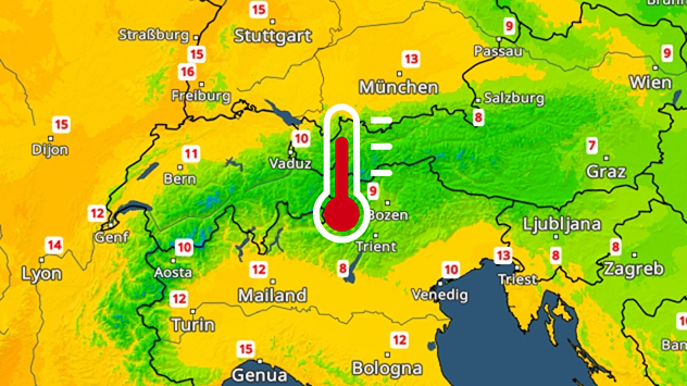
De weerkaart laat voor het seizoen vrij hoge temperaturen zien in het Alpengebied. Zelfs op grote hoogte is er nauwelijks nog vorst.
zaterdag 6 december 2025

Volgende week zeer zacht

Dooi tot hoog in de bergen
dinsdag 9 december 2025

Tussen zomer en winter

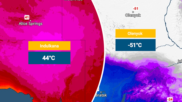
Bijna 100 graden temperatuurverschil
donderdag 4 december 2025

Storm, regen en sneeuw

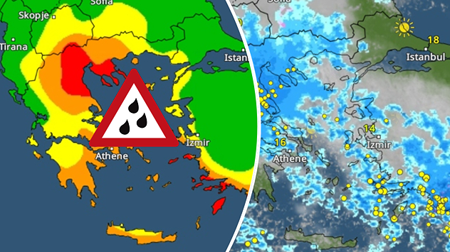
Extreem weer aan de Middellandse Zee
Alle weernieuwsberichten
Ook interessant
donderdag 4 december 2025

Temperatuur loopt op

Weekend met geregeld regen
zondag 14 december 2025

Weer&Radar uploader

Stuur jouw weerfoto van de week!
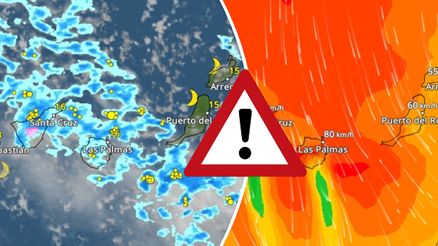
Weerkaart met regen- en windvelden boven de Canarische Eilanden en centraal waarschuwingssymbool.
vrijdag 12 december 2025

Storm en regen

Turbulent weer op de Canarische Eilanden
Alle berichten
Weer & Radar

Weer & Radar is ook beschikbaar op

Google Play StoreApp Store

Bedrijf

Contact Privacy Policy Colofon Toegankelijkheidsverklaring

Diensten

Uploader

Socials

facebooktwitteryouTubelinkList